Mike Ross for Maricopa County Supervisor 2004
Maricopa County District 1 Map
This map of Maricopa County Show where District 1 is.
Basicly its on the east side of Maricopa County and
includes Tempe,
Guadalupe,
Ahwatukee (Phoenix everything south of South Mountain),
Mesa (everything west of Country Club
and east Mesa south Baseline and east of Power Road),
Gilbert,
Chandler,
Queen Creek and
south Scottsdale.

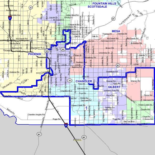
This map of District 1 is at the street level.
It includes all of
- Tempe
- Chandler
- Queen Creek
- Guadalupe
It includes Ahwatukee which is everything in Phoenix south of South Mountain.
It includes two parts of Mesa
- everything west of Country Club
- in east Mesa most of the area
which is south Baseline and east of Power Road.
It includes most of Gilbert which is South of Elliot.
Last it includes most of the south side of
Scottsdale between Scottsdale Road and Pima Roads
south to Tempe.
If you need to zoom in to this map to find a specific address try this URL:
http://156.42.40.10/mapping/redistviewer/distviewer.asp?layer=bos&cities=on&field=DISTNUM&district=1&title=Supervisorial.District
For other Maricopa County Election District Maps you can
check this URL:
http://156.42.40.10/mapping/redistviewer/default.asp
Elect Mike to Maricopa County Supervisor District 1